
Schwarttzy
Sponsor
- Messages
- 1,348
- Location
- Rockford IL
I used to have one of the biggest collections of legal place to go off-road on the web. I still have all the places, but I took it down because the code was dated and needed to reworked. About a month ago, I knew that the time had come were I had everything I needed to build it with all the things I dream of in the past. So I have been hard at work with the little time that I do find and have reached the point where I feel I should share it.
The code still has a way to go before I'll finish it, but I have reached a point where I need people to test the code and offer their opinions. Keep in mind it is rough and not all the features are in place, I even need to style bunch of the code, but for the most part everything is there in some form.
I will be rating the trails 1 through 5 and have a sixth for parks. The colors are:
I also will try to indicate what the trails are like with an icon on top of the colors
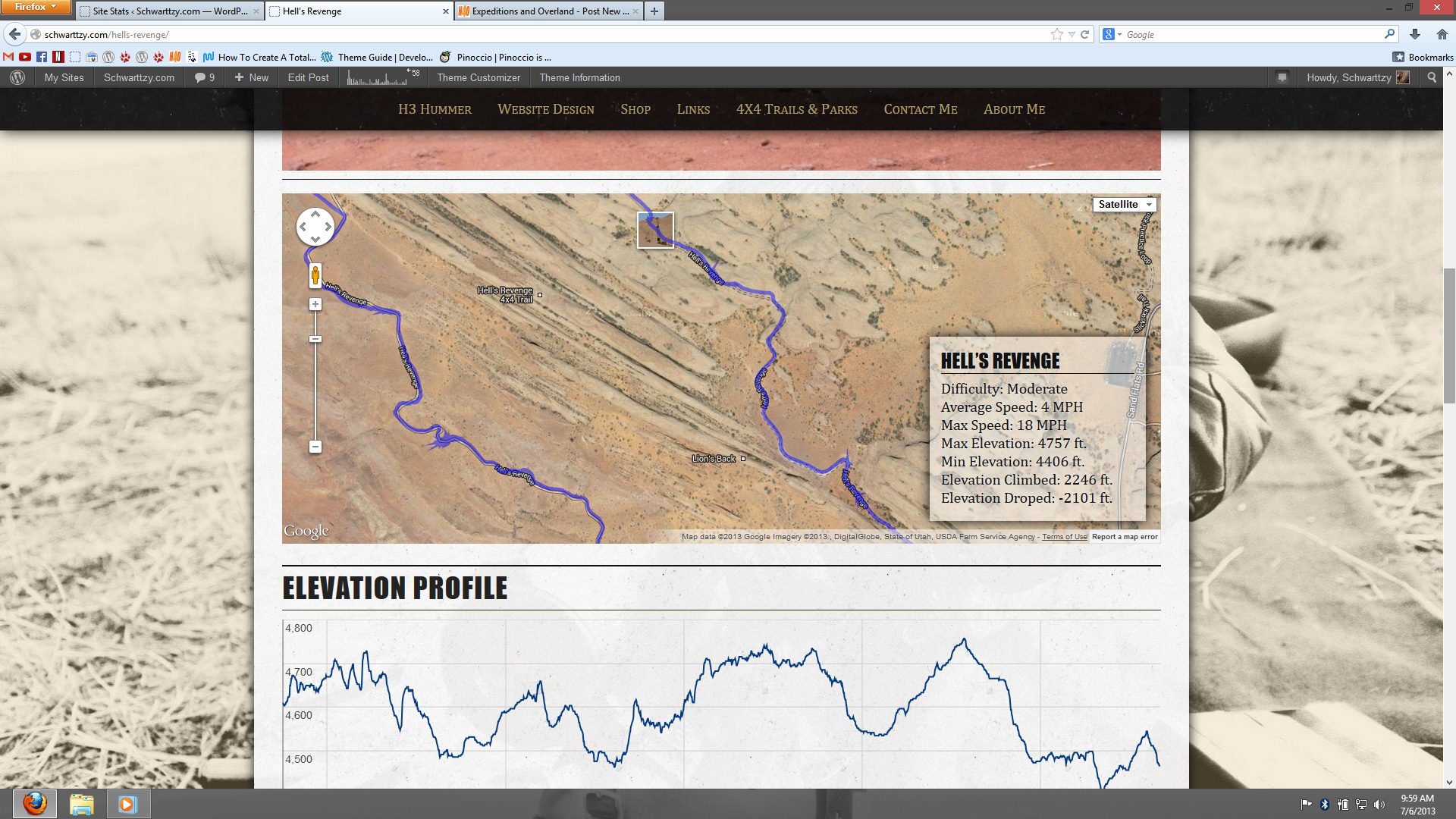
I gave the code the ability to upload GPX tracks of a trail and have them plotted on the map and mathematically pull data from it like the
Well I can only talk about it so much, so the first trail I reworked is Hell's Revenge can be seen here http://schwarttzy.com/hells-revenge/ and the map that will eventually compile all the places is here http://schwarttzy.com/trails-and-parks/
The code still has a way to go before I'll finish it, but I have reached a point where I need people to test the code and offer their opinions. Keep in mind it is rough and not all the features are in place, I even need to style bunch of the code, but for the most part everything is there in some form.
I will be rating the trails 1 through 5 and have a sixth for parks. The colors are:
- Easy - Light Grey stone
- Moderate - Deep Water Blue
- Difficult - Commando Green
- Very Difficult - Deep Cherry Red
- Extreme - Sunburst Orange
- Park - Black
I also will try to indicate what the trails are like with an icon on top of the colors
- Beach
- Desert
- Mountains
- Grassland
- Swampland
- Woods
- And any others as I feel needed
I gave the code the ability to upload GPX tracks of a trail and have them plotted on the map and mathematically pull data from it like the
- Average Speed
- Max Speed
- Max Elevation
- Min Elevation
- Elevation Climb up
- Elevation Climb down
- graphic representation of the elevation profile too.
Well I can only talk about it so much, so the first trail I reworked is Hell's Revenge can be seen here http://schwarttzy.com/hells-revenge/ and the map that will eventually compile all the places is here http://schwarttzy.com/trails-and-parks/
")