This is a bit late but I get the notices fairly often from Delorme. Get you a Texas Road Atlas so when you do hear of roads you might like you can find them.
If you happen to see this before midnight, lol because it ends then, use code 9978 to get the sale price.
http://shop.delorme.com/OA_HTML/DELibeCCtpSctDspRte.jsp?section=10096&promotion=9978
They have sales from time to time and some boxed sets that are a deal. I have sometimes missed the deadline and ordered it anyway and at check out it still showed the discount.
I will try to remember to post up when there are sales.
Most of what I do is cruising the National Forest Service roads searching for waterfalls and scenery to photograph as well as camping and canoeing. That is what is so great about the H3. I can pack up and be gone for days and never leave the state.
Here in Arkansas you can volunteer with them and you get maps with marked trails and their condition. I use my GPS map plotter program on a laptop to inventory the roads I do go down.
I was the aerial photographer for Arkansas and have mapped the entire state from 10,000 feet above mean sea level using a mapping camera that shoots 10 x 10 negatives that overlap forward 60% and we got 20% side lap consistently. Great fun, and that was before GPS!
So I'm a map guy and love to study places to go.
This is the site of a Forest tower built by the CCC and has rocks laied out to designate the location number back when WWII was ramping up. The planes could check their way points when flying on training missions.
I see lots of Texas plates in extreme West Arkansas when camping weather is nice.
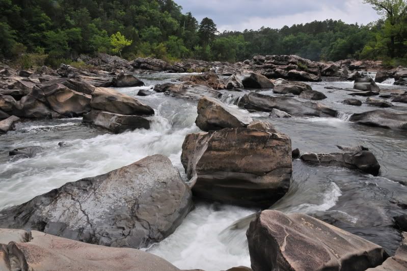
Cossatot River, great at flood stage for canoeing, when most of these rocks are submerged. I got trapped in the "Washing machine" in this picture at flood stage longer than I care to remember!!
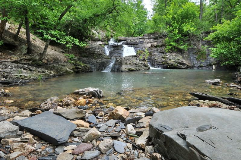
One of hundreds of falls in the back country
Maybe someday I can get up a Hummer rally get together, in all my spare time, lol.